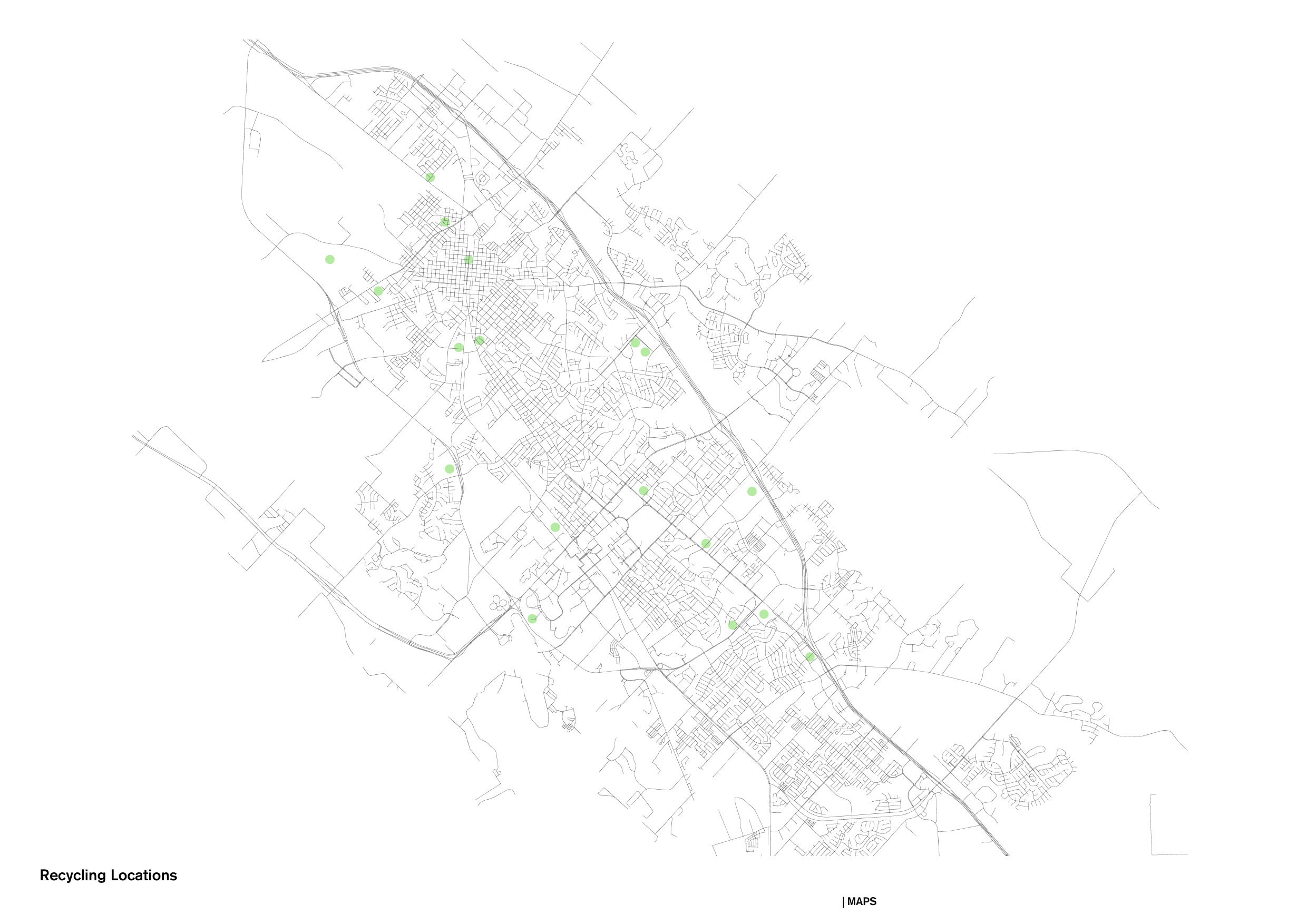
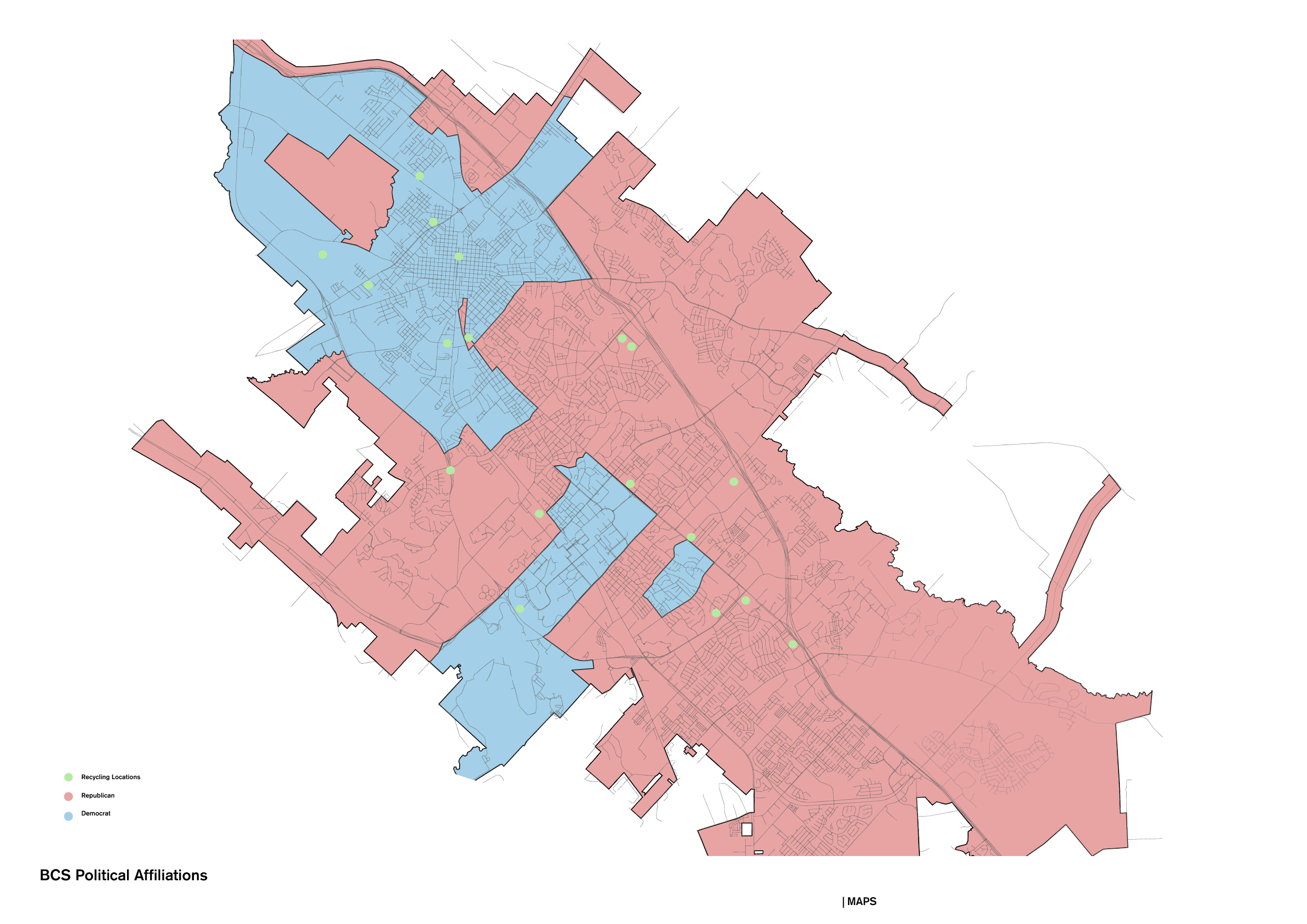
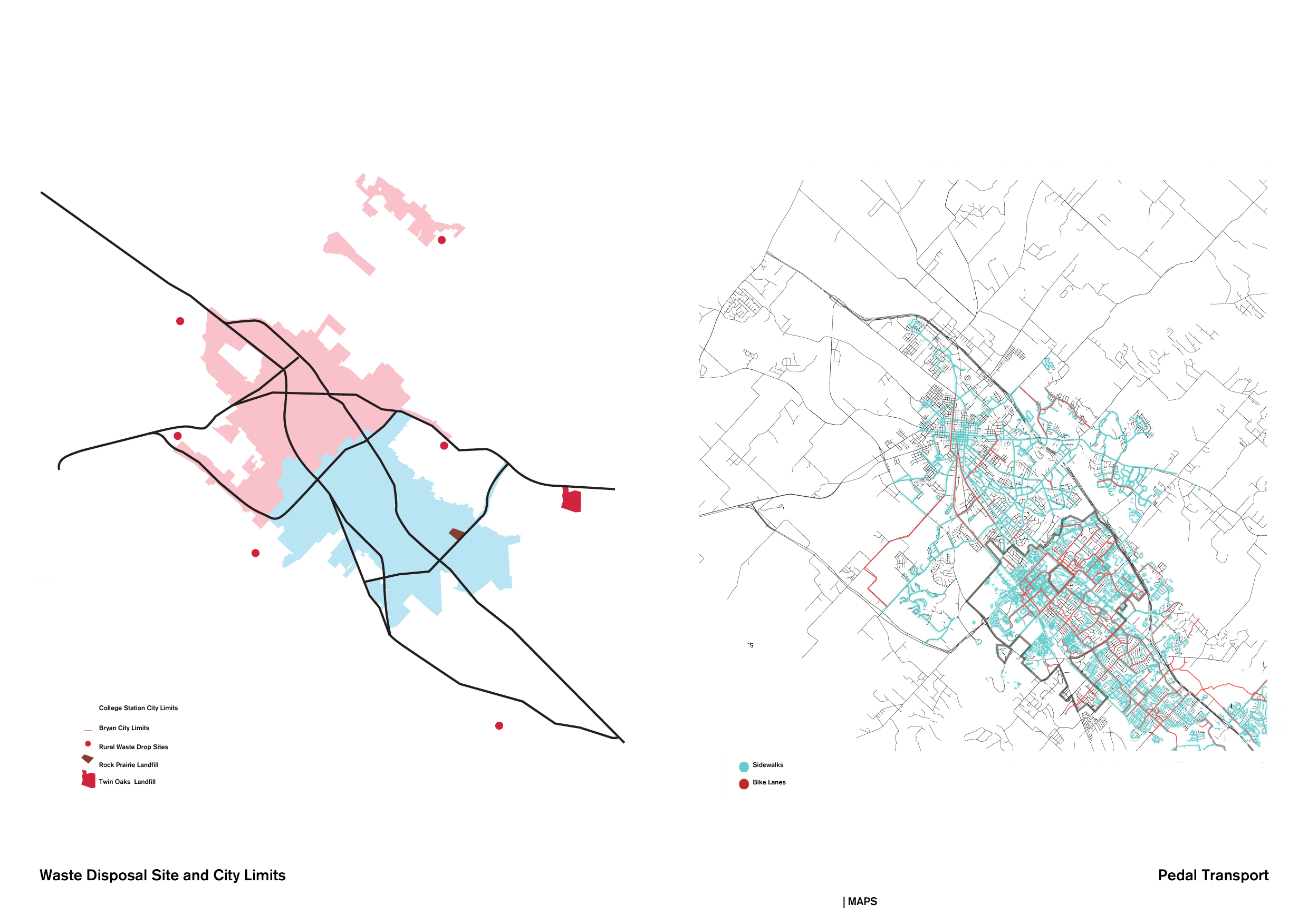
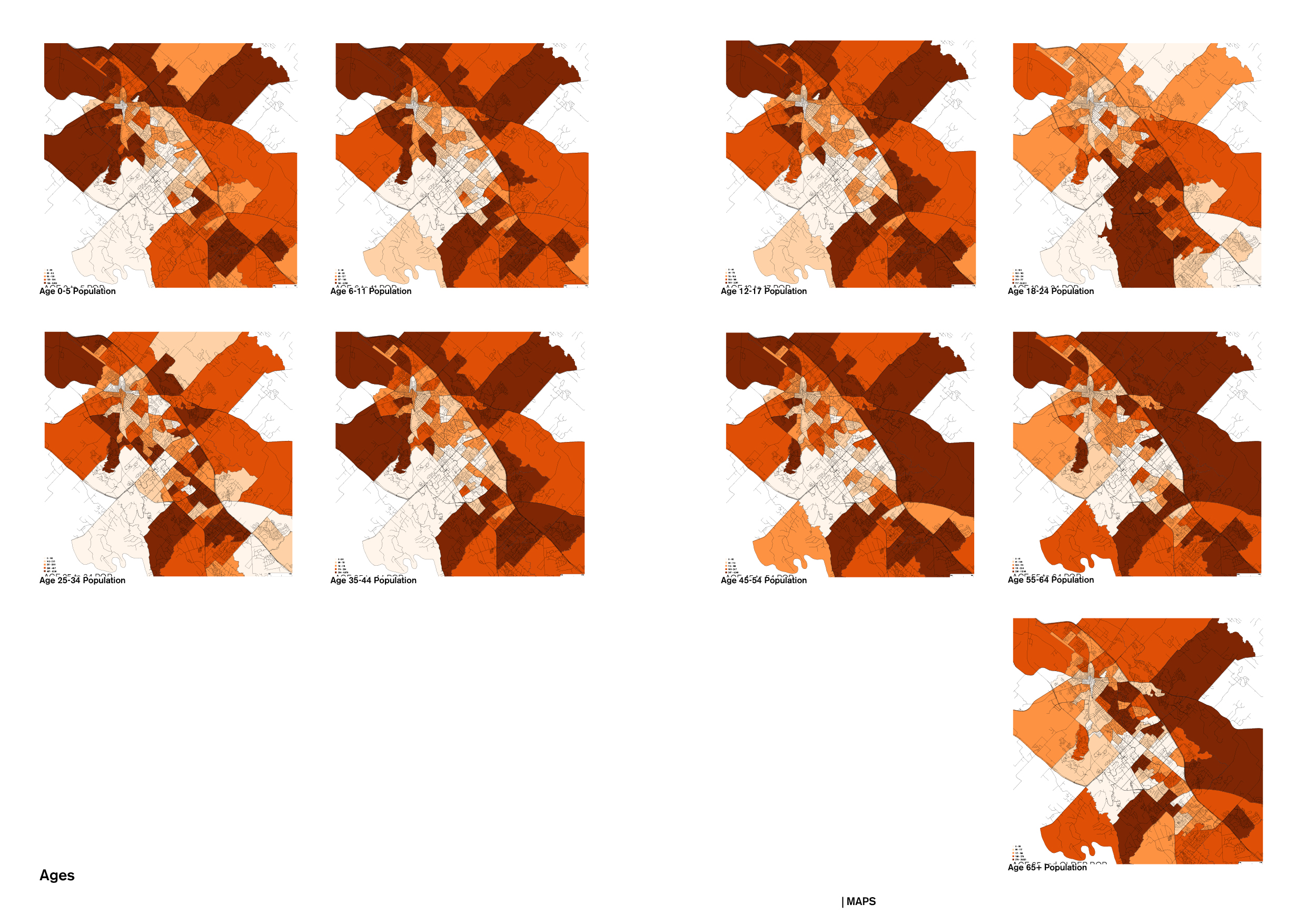
BRYAN and COLLEGE STATION MAPS The following maps document the Bryan and College Station—BCS scale combined. Since these are two different administrative cities, the following section maps are presented at their individual level.
< 36 Images >


First image, aerial view of the Bryan and College Station, Google Earth, 2021.